 01
01
The white pan and its waterholes
The defining feature of Etosha National Park, in northern Namibia, is the pan itself. It is a dried lakebed, a shimmering white expanse large enough to be picked out from space. For most of the year it lies dry and cracked, its salt-crusted surface fringed by springs and boreholes where the park’s wildlife collects.
a shimmering white expanse large enough to be picked out from space
There are no permanent rivers here. Water surfaces instead at a network of artesian springs and boreholes scattered along the pan’s edge, and in the dry months these become the points around which the whole ecosystem organises itself. Animals move between them across open grassland and mopane woodland, which means sightings come not by chance but by reading the water.


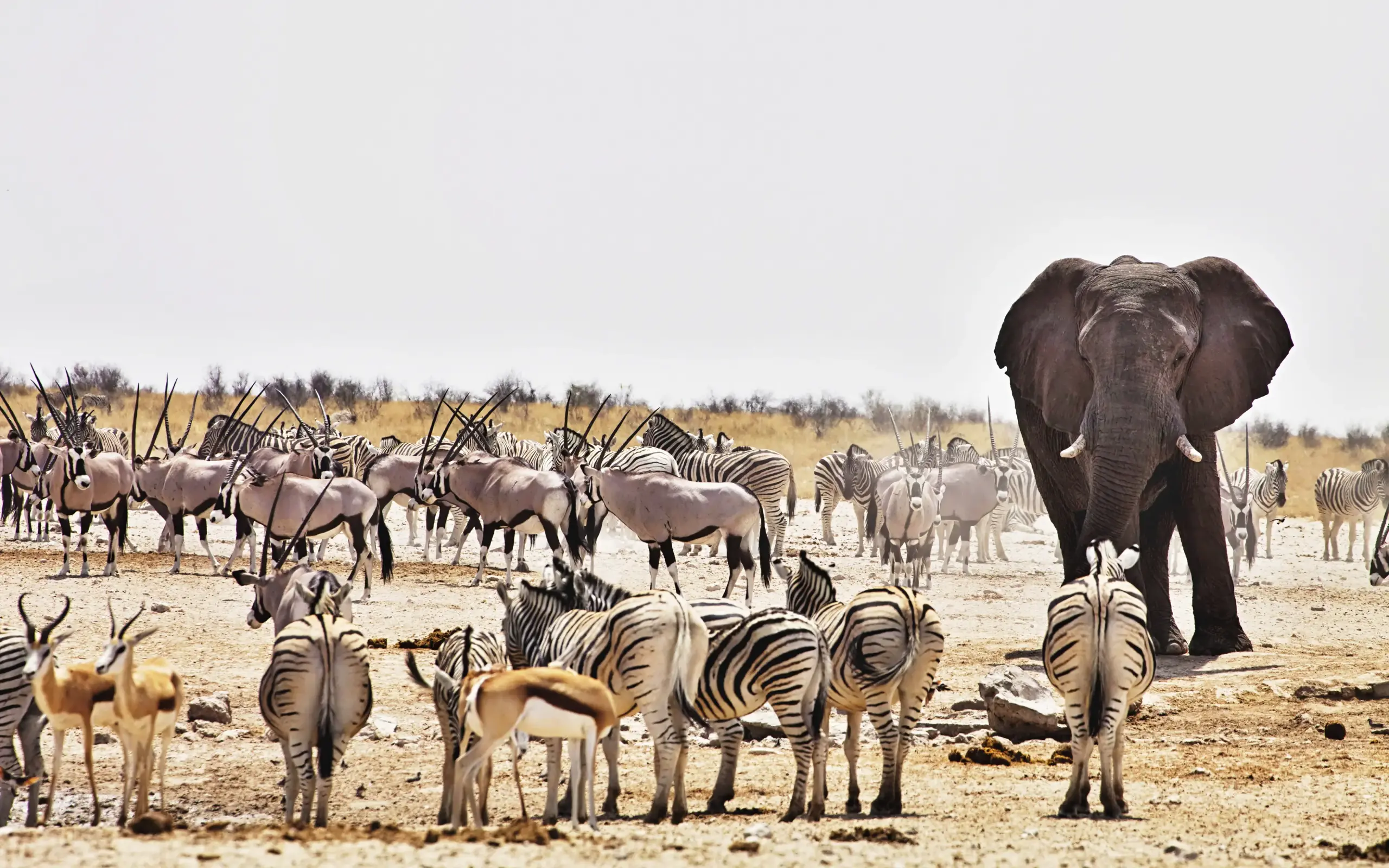
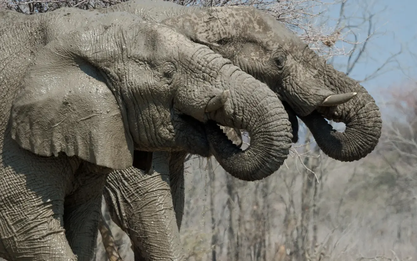
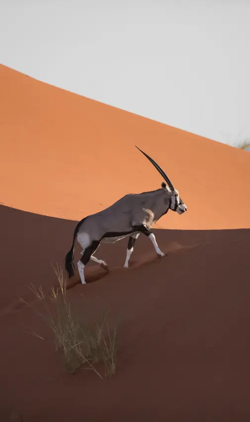
From May to October the rains hold off, surface water vanishes, and the herds have nowhere else to go. Elephants dusted pale with the pan’s calcareous clay gather at the permanent waterholes, alongside giraffes, Burchell’s zebras, springbok, blue wildebeest and gemsbok, in numbers that build through the dry season. Lions work the open margins, where the lack of cover makes them easier to find than in most savanna parks.
From May to October the rains hold off, surface water vanishes
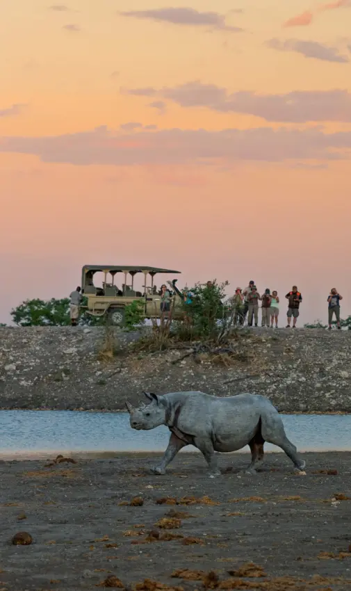
Etosha holds a significant population of black rhinoceros, and the floodlit waterhole at Okaukuejo is well known for them after dark. The rhinos arrive at night, sometimes alongside elephants and the occasional lion, lit just enough to watch without disturbing them. This seated, patient viewing at the floodlit pools is a different rhythm from the daytime drives, and one of the park’s signatures.
The name carries the landscape in it. “Etosha” derives from an Oshindonga word, a fair description of the pan’s barren centre, while the ancestral Haiom people knew it well. They lived a nomadic life, moving between the waterholes for generations before the area was proclaimed a game reserve in 1907 under German colonial administration, then declared a national park in 1967. The Haiom were forcibly removed in 1954 under South African administration and remain among Namibia’s most marginalised communities, with ongoing legal claims seeking recognition of their ancestral rights. The park today is managed by the state, with movement inside it confined to designated roads and gates that open at sunrise and close at sunset.
Mopane woodland covers much of the park, giving way to acacia and thorn-shrub savanna and to halophytic grasses around the saline margins of the pan. Dolomite hills break the otherwise flat terrain in the west. The waterholes carry names that recur on any Etosha map. Okaukuejo, Halali, Namutoni, Dolomite, Olifantsrus and Onkoshi mark the main camps, while Okondeka, Goas, Sueda and Salvadora lie out on the plains. Okondeka is a known spot for lions, and the rocky country around Halali and Goas rewards those searching for the more elusive leopard.
“Etosha” derives from an Oshindonga word, a fair description of the pan’s barren centre, while the ancestral Haiom people knew it well.
Several large private reserves border the park, and the distinction matters for how a trip is built. Inside Etosha National Park, activity is restricted to game drives on the road network during daylight, plus guided night drives run from the main camps and viewing at the floodlit pools. The bordering reserves operate under their own rules, opening up off-road driving, walking safaris and rhino tracking on foot. A stay that combines both gives the scale and concentration of the park alongside the closer, more flexible experience of a private reserve.
Etosha pairs naturally with Namibia’s desert and coast. Light aircraft connect it in around 2 to 2.5 hours to the red dunes of Sossusvlei, the desert-adapted elephants and rock engravings of Damaraland, and the fog-bound shipwrecks of the Skeleton Coast. The contrast is the point: the pan’s wildlife concentration set against some of the most desolate desert and coastline on the continent. Helicopter transfers open up scenic aerial routes over the pan and beyond, turning the logistics of a remote country into part of the experience itself.

The best time to visit Etosha National Park
Jan
Feb
Mar
Apr
May
Jun
Jul
Aug
Sep
Oct
Nov
Dec
Recommended
Transitional
Challenging conditions
Come between May and September, when seasonal water has gone and animals crowd the permanent waterholes against thin vegetation. July and August are the peak: cool days, cold dawns and big mixed herds with predators close behind, watched well from the floodlit waterholes. October pushes 35 to 40 degrees. The green season is best for flamingos and calving.
accommodation in etosha national park
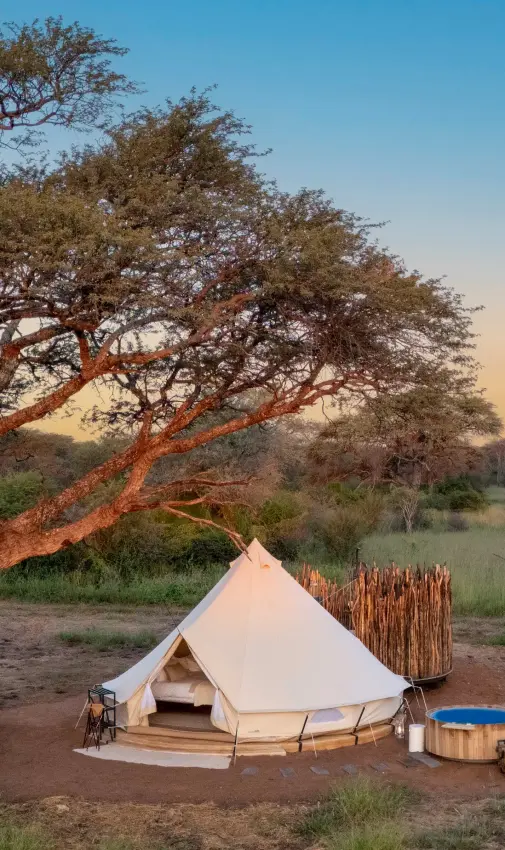
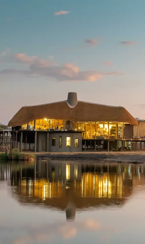
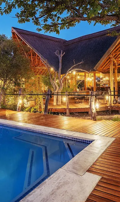
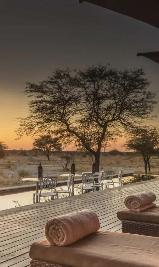
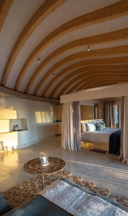
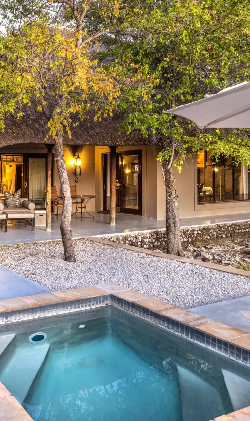
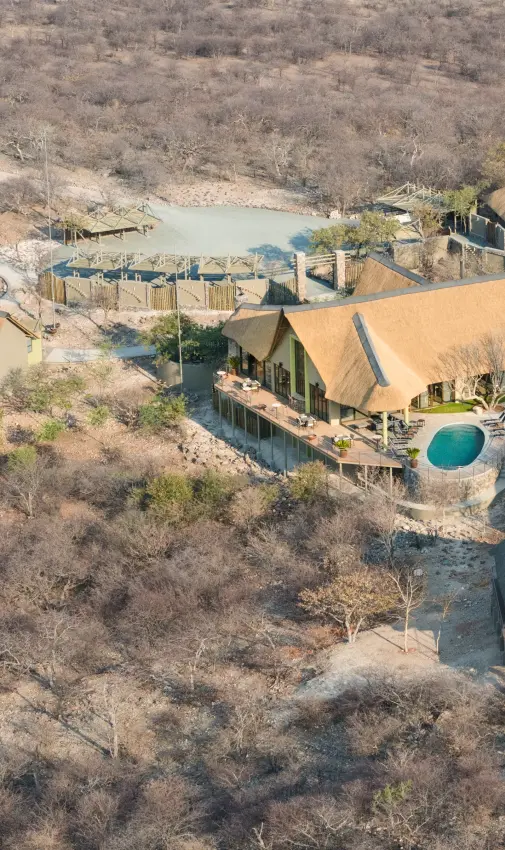
Inside Etosha National Park, state-run camps range from campsites to comfortable chalets, including premier waterhole chalets with direct views onto the floodlit pools at the main camps, and smaller, lower-impact camps in the restricted west and on the edge of the pan. The private reserves bordering the park hold the upper end: design-led lodges, classic tented camps, and exclusive-use villas suited to families and small groups seeking privacy and lower vehicle density.
01

 02
02
 03
03
 04
04
 05
05
 06
06
 07
07
 08
08
 09
09
 10
10
 11
11
 12
12
 13
13

activities
Activities
Inside the park, days are spent on guided game drives along the road network, with guided night drives and floodlit waterhole viewing from the main camps. The bordering private reserves add walking safaris, rhino tracking on foot, off-road driving and photographic hides not permitted within Etosha itself.

conservation
Conservation Projects
The Etosha Ecological Institute at Okaukuejo, founded in 1974, oversees long-term research on wildlife populations, disease and vegetation. The Black Rhino Custodianship Programme translocates animals from Etosha to establish new populations elsewhere. The Greater Etosha Carnivore Programme studies lions, leopards and other carnivores across the wider landscape.

getting around
Connectivity and Logistics
Light-aircraft charters are the standard approach for the luxury market, flying from Windhoek in roughly 75 to 105 minutes to airstrips serving camps and reserves at Ongava, Onguma and Mokuti. By road, Andersson's Gate in the south is reached from Windhoek on paved roads.
other areas in namibia
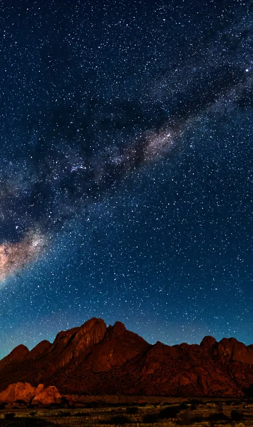
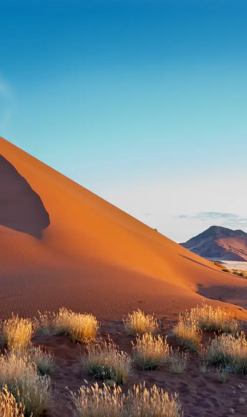
Etosha pairs naturally with Namibia's desert and coast. Sossusvlei, in the Namib-Naukluft, holds towering red dunes and the white clay pan of Deadvlei. Damaraland offers rugged geology, desert-adapted elephants and rhino, and the rock engravings of Twyfelfontein. The Skeleton Coast runs remote and fog-bound, its beaches scattered with shipwrecks and Cape fur seal colonies. The Kaokoveld, further northwest, is wild frontier country home to the semi-nomadic Himba.
 01
01
 02
02
 03
03
 04
04
 05
05
 06
06
 07
07
 08
08
frequently asked questions
By road from Windhoek, or by light aircraft to the lodge strips.
The drive is four and a half to five and a half hours, most of it on tarred road, and it is straightforward in a hire car. Flying takes an hour to an hour and a half from Windhoek's Eros airport and lands on the reserves beside the park.
A private charter, typically a Cessna Caravan or a Pilatus PC-12, can be timed to your international arrival.
We book whichever suits the wider route and build the connecting leg in where it helps.
The pan, and the way the wildlife has to come to water.
Etosha is built around a vast salt pan that is dry for most of the year, so in the dry season the game has no choice but to gather at the waterholes. You sit still and the park comes to you: elephant, black rhino, lion, and plains game in numbers.
Several lodges have floodlit waterholes where rhino come in after dark, which is some of the best game viewing in Namibia and needs no vehicle at all.
It is also one of the easier parks to self-drive, which is rare in this part of Africa.
Seasonally, yes. Etosha sits in Namibia's north, where the risk rises in the warm, wet summer from about November to April and falls away in the dry winter.
TravelHealthPro, the UK's official travel health service, and the CDC both treat the northern regions as the risk areas, and low risk is not the same as no risk.
We do not make medical recommendations. Which tablets suit you, and what is right for a child, are questions for your own doctor or a travel clinic.
On the practical part, cover up at dusk and carry repellent.
Not inside the national park, but you can on the reserves beside it.
Etosha itself keeps park rules: gate hours, no walking, no driving after dark. The private reserves on its boundary run guided walks and night drives, and their vehicles can leave the track.
Walking safaris on those reserves are usually for sixteen and over.
The pattern we book most often is a couple of nights inside the park for the waterholes, then the private land for the walking and the after-dark drives.
Yes, and the floodlit waterholes are the reason.
A child who would fidget through a long drive will sit for an hour watching rhino come to drink after dinner. Several lodges have family suites, and the shorter distances inside the park suit younger children.
Policies vary: some lodges take children of any age, others start at six, and a few ask for a private vehicle where children are under about twelve.
Tell us their ages and we will pick the lodges that genuinely work.
Three, and four if you want both the east and the west of the park.
Etosha is large and the waterholes are spread along its southern edge, so two nights means one full day and a lot of driving. Three lets you take your time and sit at water rather than chase it.
On a Namibian route it usually follows Damaraland or the Skeleton Coast, and precedes Windhoek.
Tell us the whole route and we will say how many nights it earns.
rated five stars by our clients

our approach
remote, exclusive
& personal
Every journey starts with a conversation. We take the time to understand your vision before we start planning.
Whether by phone or in person, we work with you directly to shape something that is considered, personal, and expertly delivered.
Every journey starts with a conversation. We favour a direct, personal approach: understanding your vision before anything else.
Whether by phone or in person, we work with you directly to shape a journey that is both thoughtfully considered and expertly delivered.
Get in touch to start planning yours.